
A hydrographic survey is the science of measuring and describing physical features beneath water bodies—rivers, lakes, seas, and oceans. It plays a crucial role in navigation safety, marine construction, environmental monitoring, and coastal management.
Hydrographic Survey
Hydrographic surveying involves collecting data about:
- Water depth (bathymetry)
- Bottom topography and sediment type
- Tides and currents
- Underwater structures and obstructions
Using specialized equipment, surveyors produce nautical charts, depth maps, and 3D models of underwater terrain to support both civil and environmental engineering needs.
Key Technologies Used
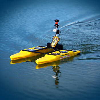
- Echo Sounders (Single-beam & Multi-beam)
For measuring depth accurately. - Side-scan Sonar
For imaging the seabed and detecting underwater features. - GPS/RTK GNSS
For precise geolocation on the water surface.
Applications of Hydrographic Survey
1. Port & Harbor Development
Designing, dredging, and maintaining safe water depth for navigation.
2. Bridge & Dam Construction
Mapping underwater features for foundation planning.
3. Inland Waterways & Navigation
Creating safe navigation routes and updating nautical charts.
4. Environmental Monitoring
Studying sedimentation, erosion, and aquatic ecosystems.
5. Offshore Projects
Supporting oil & gas exploration, submarine cable laying, and wind farms.